
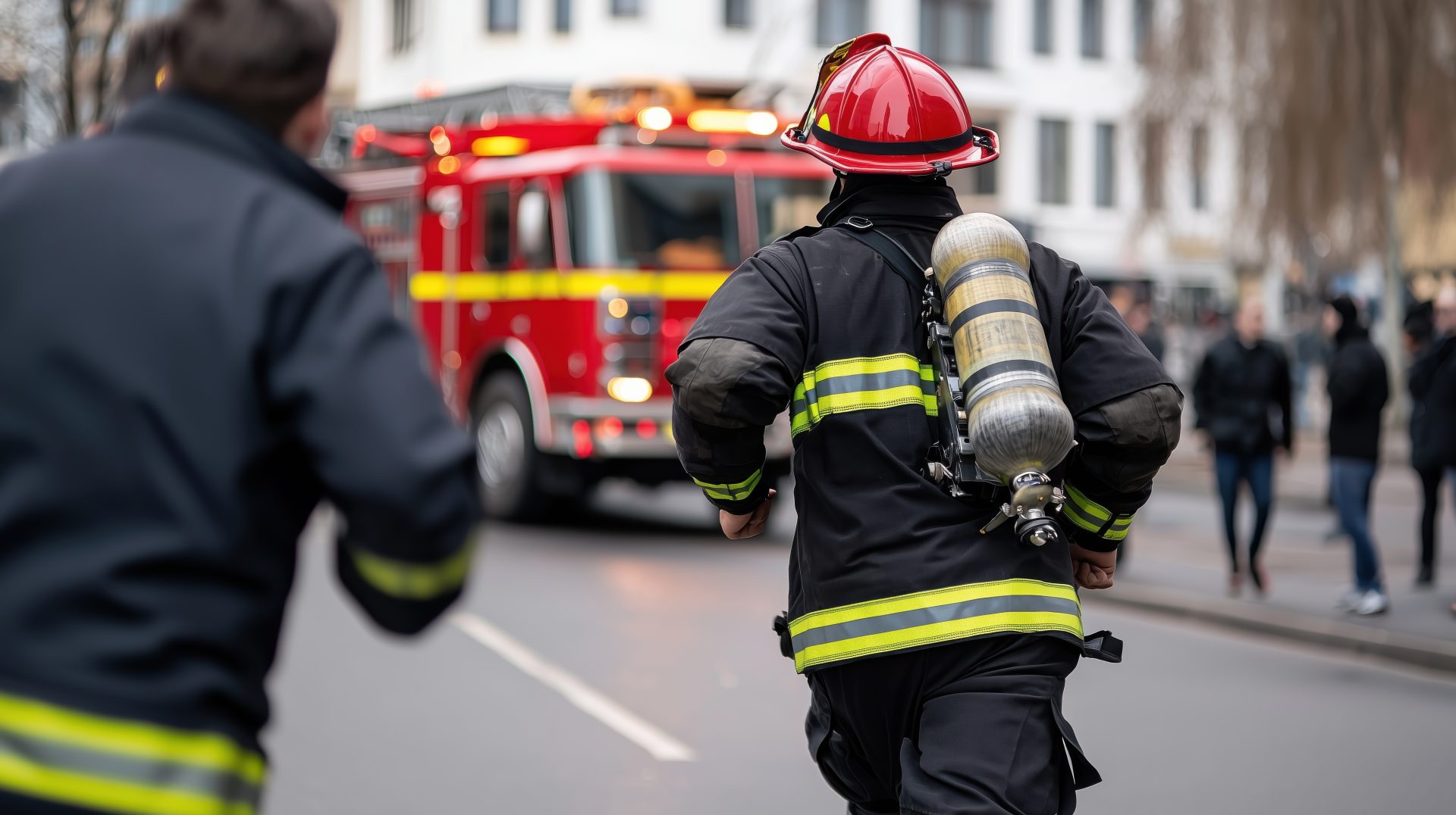
Public Safety & Emergency Response
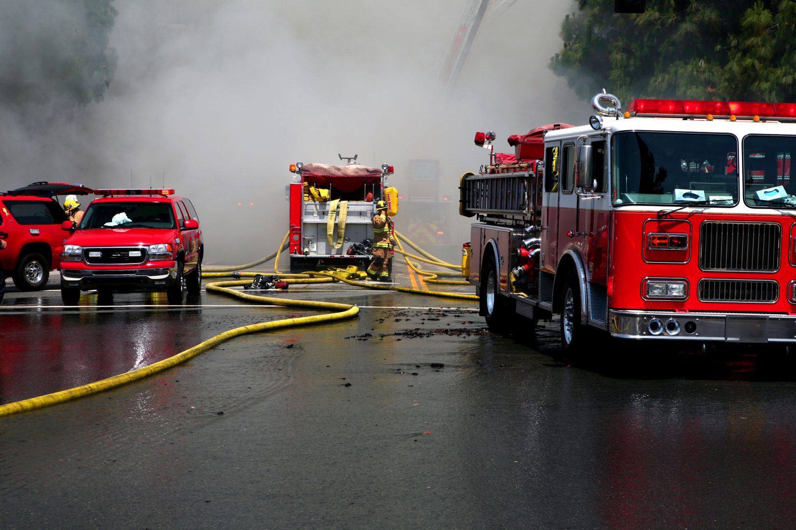
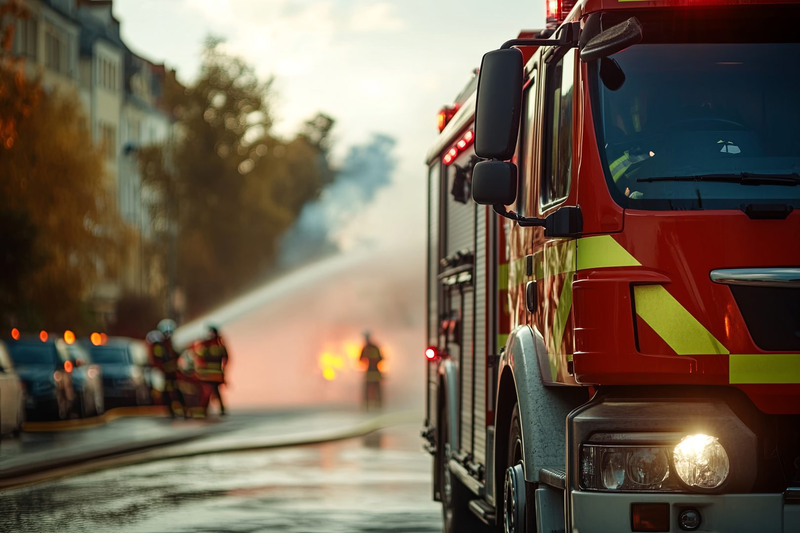
Utilising dedicated emergency response vehicles such as fire trucks and tankers, command vehicles, ambulances, and air and marine vessels, our solution uses these assets as mobile nodes with a combination of multiple connectivity (mobile broadband (4G/5G), LEO satellite and Mesh connectivity) to create a seamless and reliable network for real time communication, tracking and data collection amongst first responders.
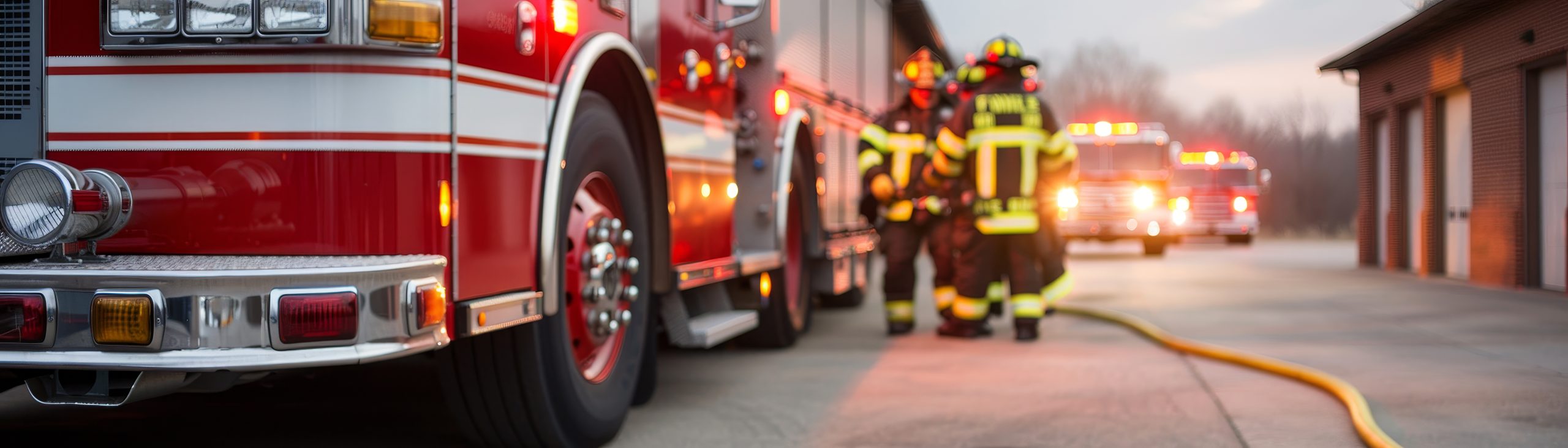
Connecting our heroes: Enabling public emergency response teams to save lives
Utilised by all first responder teams
Public Emergency Rescue
Medical Rescue
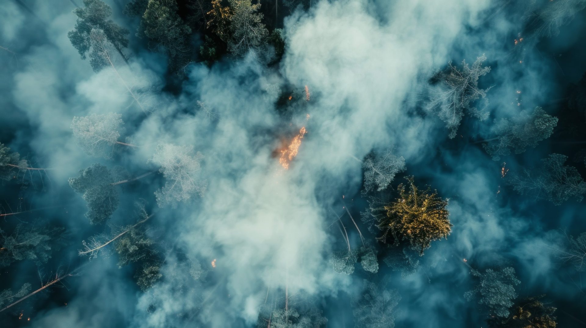
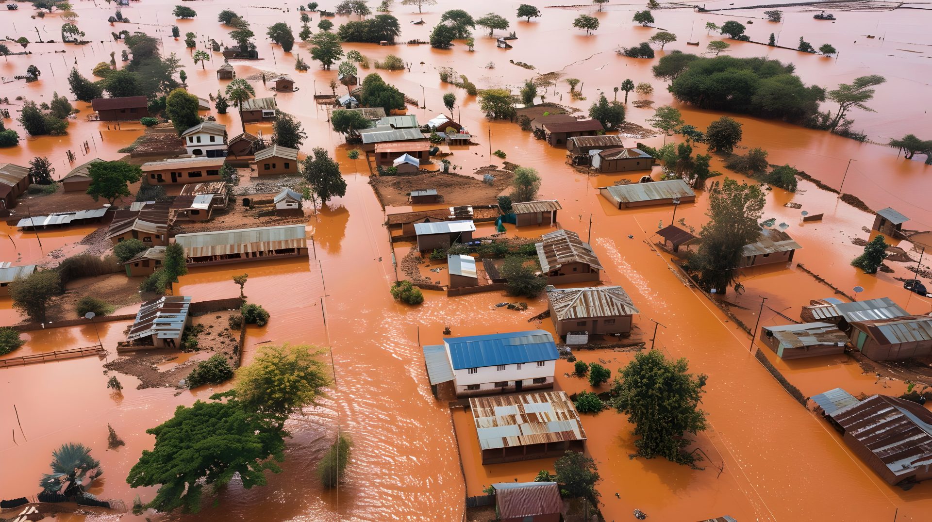
Natural Disaster Rescue
Search and Rescue
Fire Brigade Department
Police
Ambulance

Deliver internet connectivity to devices in vehicles
Using vehicles as nodes, maintain mobile connectivity on multiple moving vehicles such as fire trucks, ambulances and rescue vehicles, especially during critical rescue times in low connected areas, where vehicle location tracking and communication between first responders is crucial.
Access critical information in a timely manner
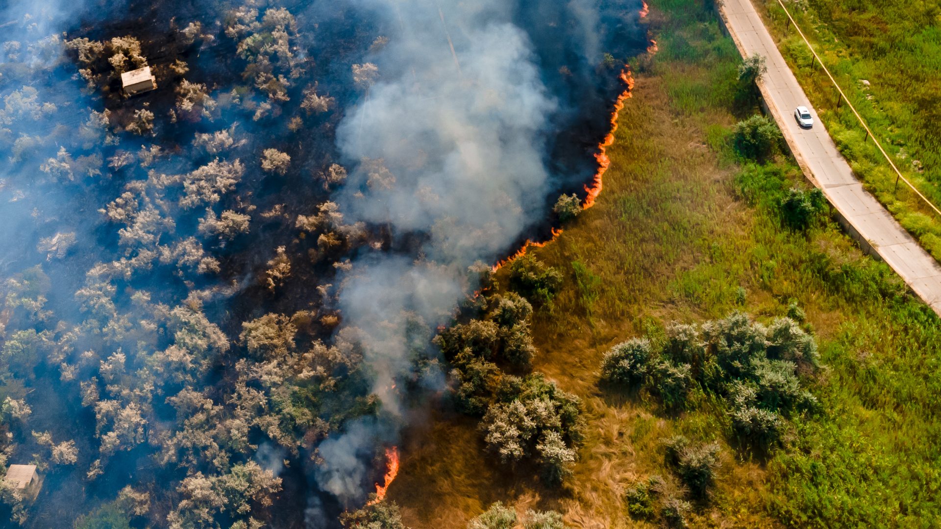
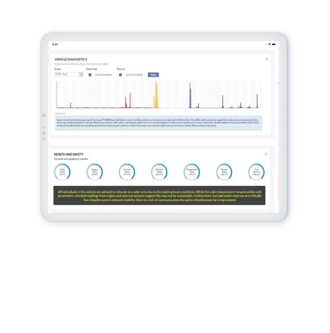
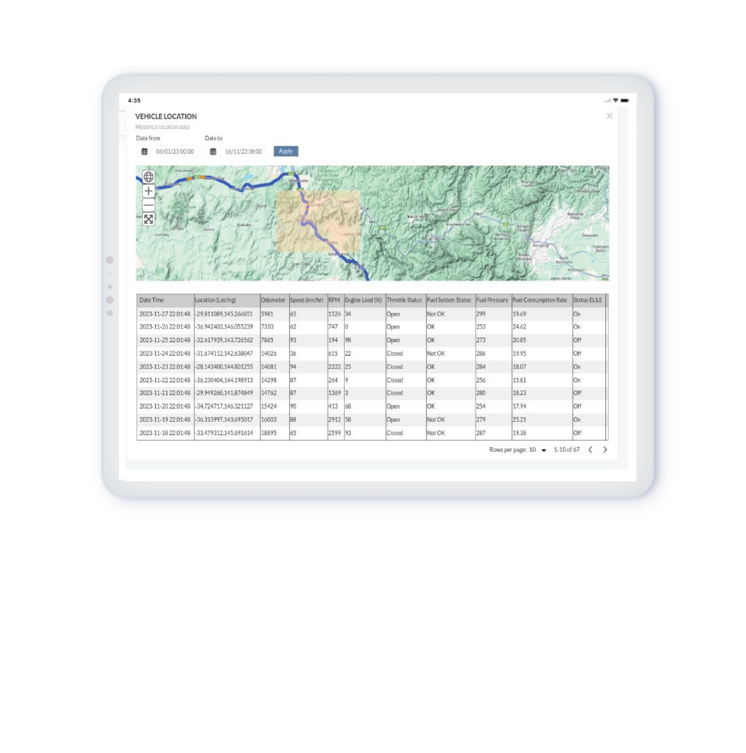
Access data such as area of fire spreads, barometric readings, flood water levels and locations of rescue team members and assets in real time while in the field.
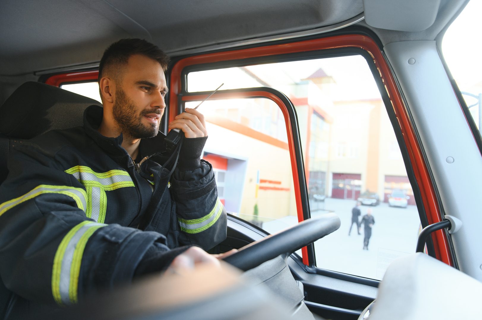
Real time communication
Communicate and share crucial information effortlessly among field teams who require situational awareness of environmental conditions. Stay up to date, even across wide areas, and keep everyone updated on situations like fires, floods, tricky landscapes, and weather changes.
Did you know
95411
incidents were attended by Australian emergency service teams in 2022
413570
emergencies were attended by Australian emergency service teams in 2022
97%
of first responders encounter issues with their mobile devices’ connectivity
43%
of those said that the issues they experience with devices cause increased stress levels for both them and their teams
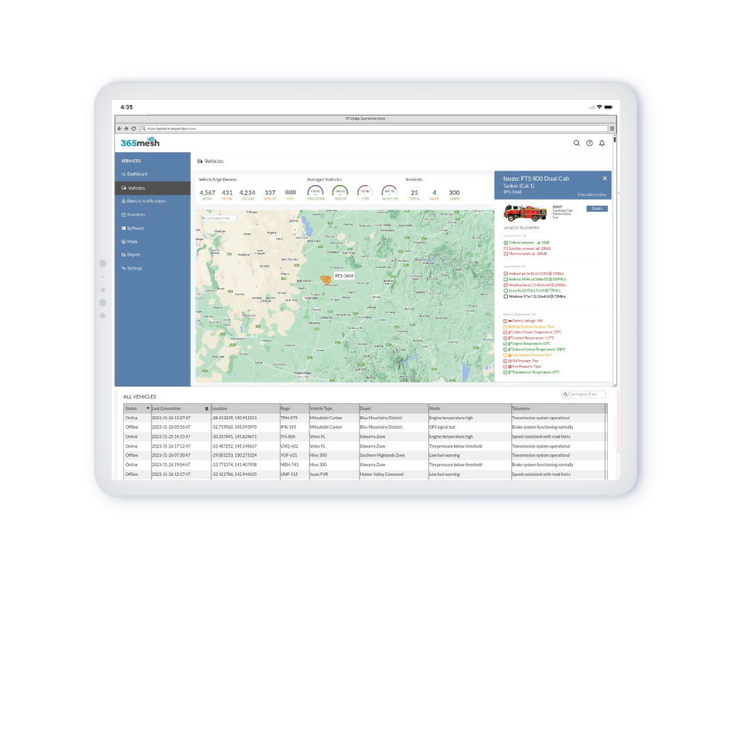
Collect data to be used for scenario visualisation
Visualise asset location and telemetry data in real time. Incorporate high-resolution satellite and drone imagery to provide advanced situational awareness. 365mesh provides up-to-date satellite imagery that enables firefighters and rescue services to visualise a fire’s progression on a map, alongside other vital information like water sources, infrastructure, and evacuation routes.
Farmdeck Electric Fence sensor

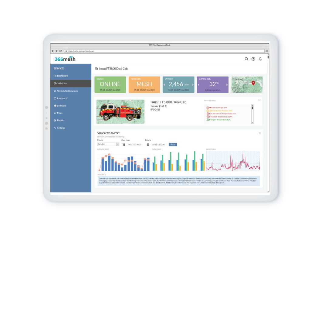
Gain real time connectivity visibility safely while on the move
Be informed in real time about connectivity availability, strength and accessibility while in the vehicle (on screens). 365mesh’s dashboard requires low touch user interaction with a simple user interface, ensuring that vehicle drivers can safely comprehend the information on screen while driving without the need to touch the screen.
Receive real time alerts
Get timely alerts and notifications through proactive monitoring of incident-prone environments (bushland, dams, and rivers) and respond swiftly to emerging issues before they escalate into critical situations such as bushfires and flash floods.
All in One platform
Control your operations and manage your data on one centralized view, making it easier to configure, update, and troubleshoot.
The 365mesh platform can be used as a control and visualization platform for both vehicle node operators and command center personnel. The platform can be accessed through any web browser-enabled device and provides a platform for many other 365mesh use cases
Onemesh
Vehicle As A Node Connectivity Solution
Onemesh Emergency Responder is our self-healing, vehicle-as-a-node solution and is designed to keep emergency first responders connected, especially during times of urgency in remote highland areas where connectivity is low.
We utilise dedicated emergency response vehicles, such as fire trucks and tankers, command vehicles, ambulance, police and air and marine vessels, as mobile nodes with a combination of multiple wireless transmission technologies (mobile broadband (4G/5G), LEO satellite and Mesh connectivity), as well as vehicles positioned near permanent cell towers or satellite uplink sites, to connect directly to the mainstream mobile network, facilitating a seamless and reliable network for real-time communication, tracking and data collection among first responders, control rooms and other essential services.
With long range connectivity capabilities of up to 5km from node to node, speeds of up to 500mbps (up to 1gbs in geographical areas other than Australia) and being able to utilise up to 32 mesh nodes in a network, our solution has been proven to showcase strong and reliable connectivity, particularly in harsh environments.
This solution is used by emergency, disaster and medical response services, search and rescue teams, bushland firefighters, police and other organisations that ensure public safety, security, and health by addressing and resolving emergencies.
See how Outcomex, Platinum reseller of 365mesh utilises 365mesh sensors, connectivity capabilities and dashboards to give our emergency responders the ultimate support they need.
Interoperable, flexible and scalable
Embrace the future of emergency response with our adaptable solution. As the technology continues to evolve, and new advancements emerge, our solution remains flexible, ready to be installed in a wide range of dedicated emergency response vehicles that are currently being used and/or may be introduced in the future.
Improve disaster preparedness and response through our IoT-enabled monitoring, prediction and early warning solutions.
Use cases for monitoring, prediction and early warning solutions
Air quality monitoring and detection of various hazardous air particles
Water body and flood monitoring and alerting
Infrastructure monitoring and maintainance
Vehicle and fleet tracking
Vehicle rollover alerts
Vehicle health and usage monitoring
Object, people and animal idenification, recognition and classification
Create virtual boundaries and receive boundary alerts (bushfire spreads)
Heat mapping
Disaster time-lapse (cameras satellite imagery)
Land and aerial surveillance
In field safety gear detection
Wearable devices for rescue team tracking
Smart body cameras
Search and rescue using advanced radar technology
take 365mesh into your hands
Partner with us
Through the partner program, 365mesh allows its program partners the opportunity to provide their own customer base with the latest IoT technology and gives them access to the highest level of expertise within the tech industry.
White Label
As a cloud-based IoT provider, 365mesh technology is strategically designed to be used as a white labelled solution that meets numerous industry needs and fulfils multiple use cases. 365mesh integrates with numerous data sources and sensors, allowing your customers to gain a deeper understanding into industry needs.